Bog Brook Cove
Cutler & Trescott
Jump to
GUIDELINES
What You Need to Know
- No camping permitted
- Campfires permitted (with restrictions)
- Carry out all trash (see details)
- Stay on established trails
- Foot traffic only (not suitable for wheeled vehicles)
- Keep pets under control
- Respect privacy of preserve neighbors
- Do not pick blueberries (see details)
WHY WE CARE
Coastal Adventure Awaits
Throw on your backpack and explore the 5.5 miles of trails at Bog Brook Cove, which offers options for all abilities to enjoy. The most accessible trail follows a wide, gravel path 0.2 miles to a rocky point with scenic views of Grand Manan Island. Whichever route you choose, you’ll discover dramatic views, bluejoint meadows, coastal peatlands, and cedar and spruce-fir forests. Keep an eye out for warblers, sandpipers, bald eagles, and seabirds along the way. This preserve is a truly special place to explore—one we’re proud to protect.
Features
How to Get There
There are two main parking areas for the preserve. The South Lot, located right on Route 191 in Cutler (18.5 miles from the Route 1/191 junction in East Machias), provides access to the Norse Pond Trail and Bog Brook Cove Beach. The North Lot is located on Moose River Road (1.1 miles east, off Route 191).
The entrance is marked by the only road with a small triangle of land in the middle. Be aware that the road starts paved but quickly becomes rough gravel. This lot provides access to the accessible trail, the beaches at Moose Cove, and the Chimney and Ridge Trails.
Explore the Map
View this preserve’s trails and features on the interactive map or download a printable copy above.
Preserve Details
Property:
Town:
County:
Accessible:
FIELD NOTES
Getting to Know Bog Brook Cove
The Path to Conservation
The Bog Brook Cove Preserve is made up of multiple adjoining parcels, interspersed with privately-owned properties. MCHT acquired the first parcel in 2005, but the bulk of the land was purchased in 2008 with support from the Land for Maine’s Future program. Together with the State of Maine’s Cutler Coast Public Reserved Land, this is part of the largest contiguous area of conservation land on the Maine coast outside of Acadia National Park.
On the Preserve
The Bog Brook Cove Preserve is a unique landscape of rocky knolls separated by gently sloping ground, swampy flats, wet meadows, and small brooks(an estimated 40% of the property consists of wetland soils). The diverse habitat is home to a great variety of wildlife, including black bear, bobcat, and fisher. Visitors have also documented sightings of two birds rarely seen in Maine: the yellow rail and upland sandpiper.
The Trails
There are four trails to enjoy on the preserve, each offering a unique experience:
- Norse Pond Trail (2.4-mile loop)
- Accessible Trail (0.2 miles)
- Ridge Trail (2.3-mile loop)
- Chimney Trail (0.7-mile loop)
A Tip From the MCHT Land Steward
“From the north lot entrance, I recommend the Ridge Trail. If you’re able, it’s worth the short climb and scramble to the top of the rocks on the first loop. You feel like you are on top of the world with sparkling water everywhere you look.”

STORIES FROM DOWNEAST
Deepening Our Connections to Nature and One Another
Our stories remind us why we commit ourselves to the work of conservation. Here in Maine, nature is still big and bold enough to remind us that we are part of it. We want to make sure this remains true.
Be part of the movement

Contribute to a future with
healthy, open lands & waters
Donate Now

Give your time to help
care for the coast
Volunteer Now

Be a champion
for conservation
Spread the Word
More Information on Bog Brook Cove
Help Us Take Care of the Preserve
This preserve belongs to all of us; that’s why it’s important to leave as little trace as possible when you visit.
To do that, please:
- Carry out all trash
- Carry out all pet waste
- Carry out all human waste (including toilet paper)
Campfires on the Preserve
Campfires permitted only on the beach—must be smaller than 3 feet. Contact the local fire department for restrictions.
Additional guidelines:
- Keep all fires below high tide line
- Do not cut or break tree limbs, dead or alive
- Leave no fire unattended
- Completely extinguish all fires
What’s up With All the Blueberries?
The preserve has a long history of human activity that includes farming and forestry. Today, roughly 80 acres of the preserve are managed for commercial blueberry harvesting. MCHT has created a guide for farmers wanting to transition to organic blueberry farming—Organic Wild Blueberry Culture: A Guide to Transitioning and Tending. When entering the preserve on the north end, you’ll pass through these privately owned fields—please don’t pick.
Choose Your Adventure
Norse Pond Trail
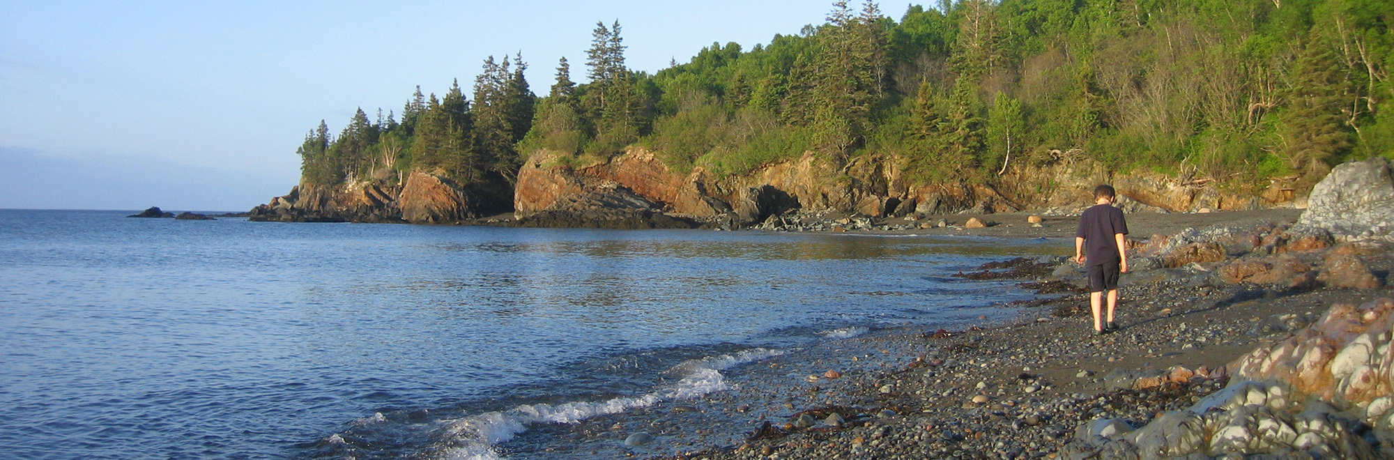
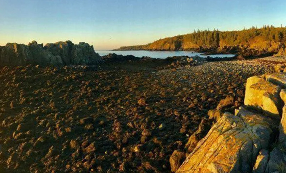
This 2.4-mile hike begins at the south lot. The path climbs up and over a couple small hills before reaching the start of the loop. Bear right to reach the shore of Norse Pond or left toward the ocean. Midway on the loop is a spur trail that descends steeply 0.1 mile to stunning Bog Brook Cove beach, where unusual rock formations can be reached at mid-tide or lower along the cobble shore.
Note: please respect the private residence located on the bluff above the beach and use caution crossing Bog Brook.
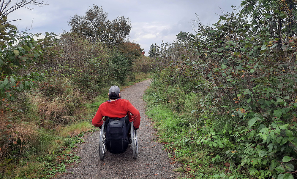
Accessible Trail
This 0.2-mile trail is open to hikers of all abilities and departs from the north lot. Follow the wide, well-groomed path as it winds gently to a scenic spot near the shoreline with a slight slope towards the end. Relax on the bench to enjoy incredible ocean views and scan the surf for wildlife.
Ridge Trail
This 2.3-mile round-trip trail is the preserve’s most challenging, but also the most scenic. From the North Lot, follow the accessible trail 0.2 miles to the trailhead on your left. You’ll quickly reach the first of two short loops:
- Stay right to carefully ascend a rocky knoll for sweeping views of the Bold Coast.
- Take the left loop to avoid the steep ridge.
The trail drops steeply from the ridge to an intersection. Follow the meandering path across the low-lying ridge and through the minor ups and downs of the main trail before reaching the start of the second loop
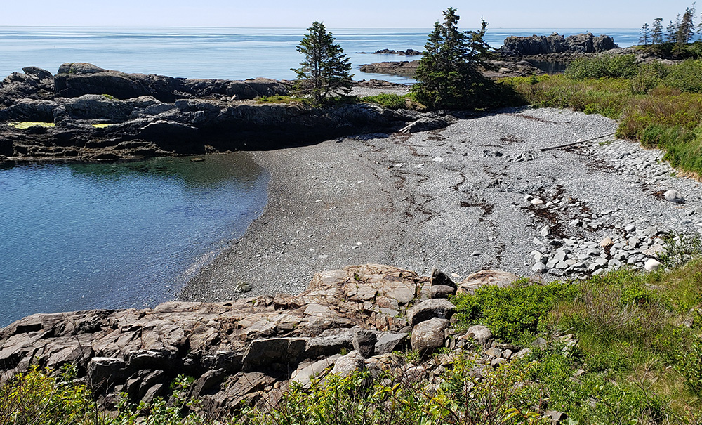
At the start of the second loop, stay right to descend rapidly toward Moose Cove (or take the left loop). A very short spur leads to the shoreline, offering opportunities to spot shorebirds, bald eagles, and other wildlife.
To exit the preserve, retrace your steps to the first loop. Stay right here and follow the route as it winds below and around the rocky knoll before turning right to return to the parking area.
Note: the loud intermittent noise you may hear in late July/August is associated with the nearby blueberry fields.
Chimney Trail
This 0.7-mile loop begins at the north lot. You’ll find the two trailheads on the south side of the parking area. Beginning on the trailhead closest to the ocean, head along the wide corridor as it leads towards the water’s edge. Some short side trails lead left to scenic coastal viewpoints.
Once past an old collapsed chimney (remnant of a house fire), the path narrows and eventually leads inland and continues around the loop, descending directly to the parking area